SMPL
Moscow [Russia], May 30: In today’s industries, there is a growing demand for specialists equipped with the necessary competencies to handle high-volume spatial-temporal data streams. These industries include territory management, national defense, navigation satellite systems, emergency situation prevention and management, construction, agriculture, geological exploration, natural resource management, critical infrastructure construction and monitoring, and energy supply facilities management, transportation, and logistics.
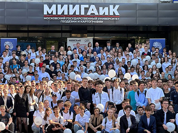
MIIGAiK stands out as the only university in Russia offering comprehensive training across various fields such as geodesy, cartography, aerial photography, photogrammetry, optical instrument making, and geographic information systems. It actively participates in the federal “Priority 2030” program, plays a crucial role in the rocket and space industry, and contributes to space science and education innovation.
The Federal Service for State Registration, Cadastre, and Cartography (Rosreestr) and MIIGAiK have formed a consortium of higher education institutions that aims to address various areas related to spatial data infrastructure and its implementation.
Distinguishing between pure math and applied math, pure mathematics aims to achieve what is possible in the necessary manner, while applied mathematics focuses on achieving what is necessary in the possible manner. MIIGAiK values applied mathematics for efficiently addressing the required tasks. With its focus on training specialists capable of tackling a wide array of modern high-tech challenges and engaging in research to solve various applied problems across industries, MIIGAiK has embraced and extensively implemented STEM education. STEM has been instrumental in driving groundbreaking discoveries and transformative technological advancements, nurturing and preparing the next generation for the future.
In addition to the previously mentioned directions, MIIGAiK’s areas of expertise include:
* Methods of computer modeling for optical and optoelectronic complexes.
* Techniques for optimizing optical systems and assessing image quality.
* Development of optical systems using freeform surfaces.
* Devices and systems for Earth remote sensing and space object observation in the optical spectrum, including multispectral and hyperspectral equipment, and spacecraft orientation and navigation instruments.
* Cartographic and geoinformation methods and technologies for spatial data analysis, modeling spatial phenomena, objects, processes, relationships, and systems, as well as organizing spatial data and knowledge using distributed and cloud technologies.
* Digital transformation of the cartographic industry.
* Theory and methods of image acquisition, as well as techniques for improving the quality of aerospace images.
* Photogrammetric processing of ground, aerial, and space images for determining object shape, size, and position.
* Creation of three-dimensional models based on various imaging methods, including those from unmanned aerial vehicles.
* Cartographic support for land, natural resources, and emergency situation monitoring.
* Identification of precursors of natural disasters based on remote sensing data.
* Aerospace research for assessing natural and anthropogenic processes.
* Application of remote sensing data for environmental protection, resource management, and disaster risk reduction.
* Sustainable territorial development, territorial planning, and urban planning zoning.
* Theoretical and methodological aspects of geoecology, including regional and local geoecological issues, geoecological mapping, and the application of remote sensing and GIS technologies in geoecological research.
MIIGAiK maintains close collaboration with Rosreest, Roscosmos, and is a member of various international organizations such as the International Society of Photogrammetry and Remote Sensing (ISPRS), the International Committee on Global Navigation Satellite Systems (ISG), the International Federation of Surveyors (FIG), the International Union of Geodesy and Geophysics (IUGG), the International Association of Cryospheric Sciences (IACS), the International Cartographic Association (ICA), among others.
If you aspire to become a highly skilled STEM-educated professional in the fields mentioned above, we invite you to pursue your studies at MIIGAiK. If you are already engaged in solving problems within these domains, MIIGAiK is open to scientific, technological, and engineering collaboration in these areas.
Established over 245 years ago, MIIGAiK stands as one of Russia’s oldest universities. Its enduring popularity stems from its commitment to delivering high-quality education and its capability to address diverse challenges in the aforementioned fields. We welcome all individuals and organizations interested in cooperation across various avenues.
The groundbreaking Indo-Russian Educational Summit 2024 has laid the foundation for promising opportunities in collaboration between Russia and India in the fields of Science, Technology, Engineering, and STEM education.
To learn more about MIIGAiK and explore potential collaborations, please visit our website at https://www.miigaik.ru.
(ADVERTORIAL DISCLAIMER: The above press release has been provided by SMPL. ANI will not be responsible in any way for the content of the same)
Disclaimer: This story is auto-generated from a syndicated feed of ANI; only the image & headline may have been reworked by News Services Division of World News Network Inc Ltd and Palghar News and Pune News and World News
HINDI, MARATHI, GUJARATI, TAMIL, TELUGU, BENGALI, KANNADA, ORIYA, PUNJABI, URDU, MALAYALAM
For more details and packages


